The Upper Poultney River

The Stats

Location:
East Poultney
Length:
2.42 miles

Class:
III+
Flow Direction:
North East

Starting Elevation:
600′

Ending Elevation:
492′

Average Gradient:
45′ / mile

Rapid Type:
Bedrock ledges and slides

River Grade:  B


The Upper Poultney is often overlooked and commonly mischaracterized. The truth: it’s a beautiful intro-creek Class III run with two hemlock-ledge gorges in west-central Vermont that has something for everyone. Put it on your list, bring a friend or two who’s getting into the sport, and tag it with another nearby whitewater run, mountain biking, gravel biking, rail trail biking, or “discovering” Poultney and Castleton. You won’t be disappointed!

Put-In

From the take out head east on route 140 for ~2.3 miles until you get to Morse Hollow Road.  Park in the pull off on Morse Hollow at this intersection.

Take-Out

From the town of East Poultney head East on route 140 for ¼ of a mile and park off the side of the road.


(Note: Folks typically drive fast around the blind corner on R. 140 at the takeout, so we recommend parking take out vehicle(s) on the pull out after the bend headed east.)


The shuttle is relatively short and flat making for a great bike shuttle or run


FLOW INFO

Online Gauge:
Poultney River Below Fair Haven, VT


Flow Range:
750 – 2500


750–950: Low
1,000 – 1,500: Medium
>1,500: High


Visual Gauge:
There is no formal visual gauge on the Upper Poultney. But the river is easily visible and scouted along Route 140 between the take out and put in. One look at the level and flow at the put in will reveal whether it’s low, medium, or high. Unlike other similar sized creeks, due to the drainage size of the watershed, it surprisingly holds water decently well post rain or snowmelt.

The route 140 bridge over the Upper Poultney river East of the town of East Poultney
A medium low level at the route 140 put in bridge

The Run

Description: Mason Overstreet and Tony Shaw | Photos: Mason Overstreet and Hector Kent

Cars, kayaks and canoes at the put in pullof on Morse Hollow Road for the Upper Poultney River Vermont Whitewater
The putin off of Morse Hollow Road

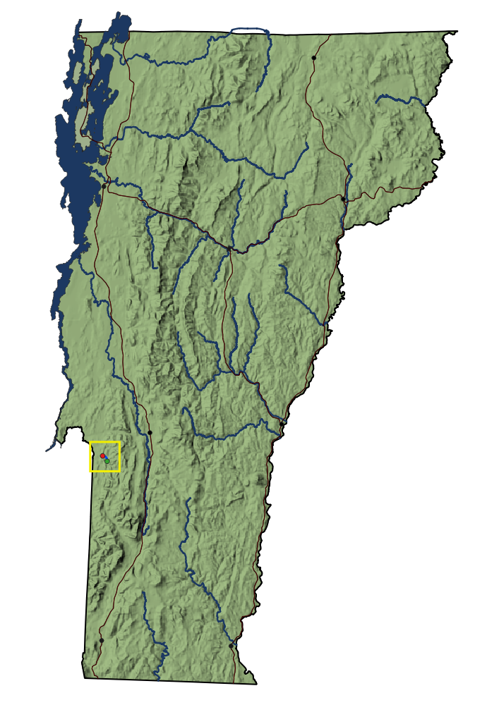
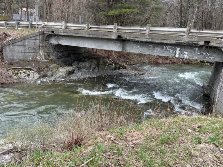
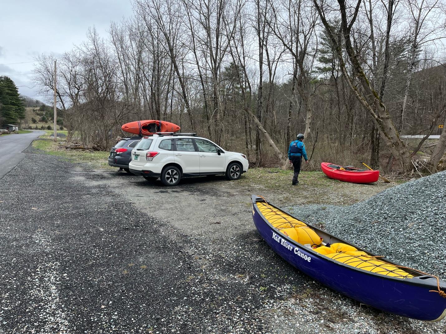
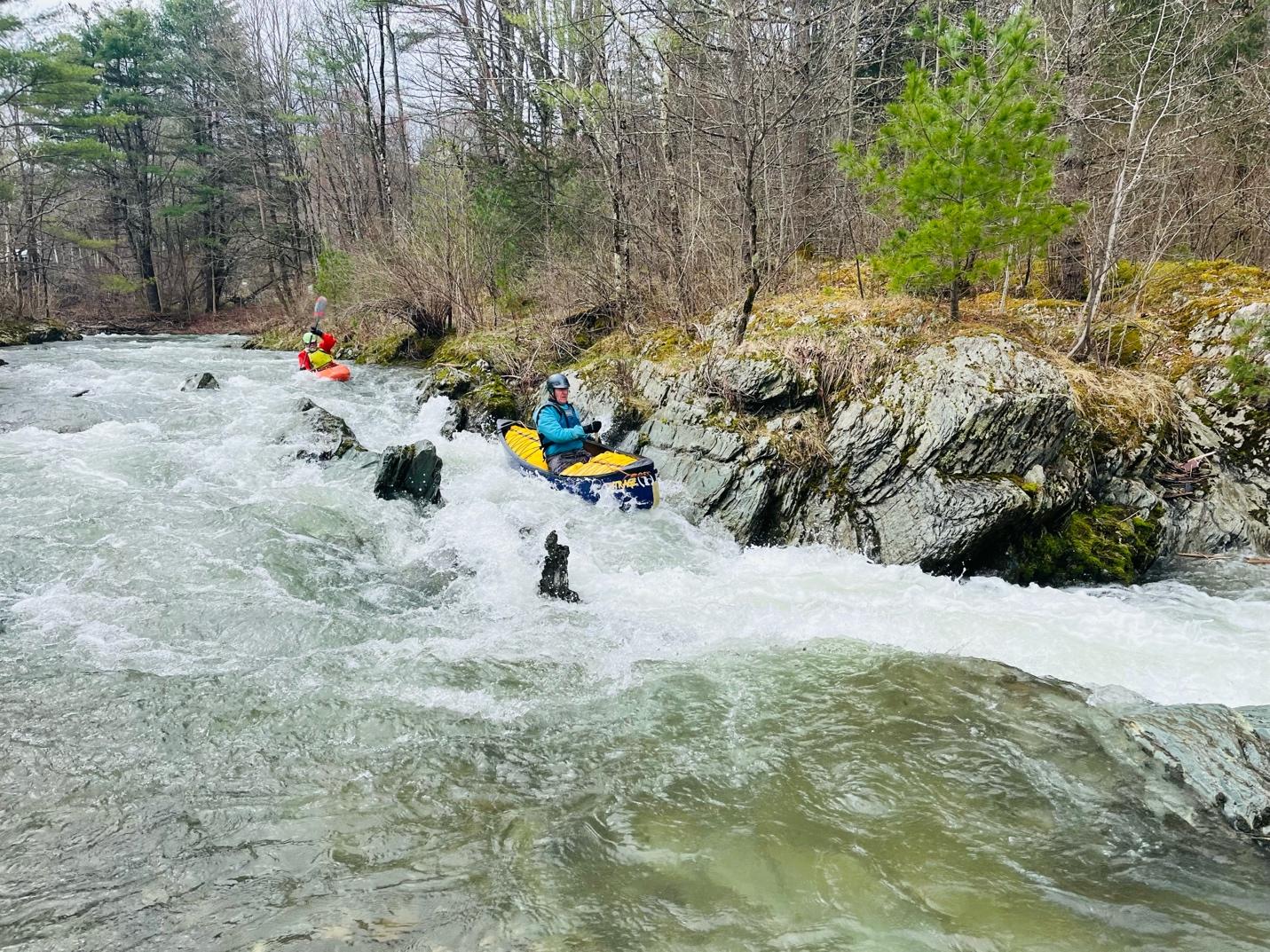
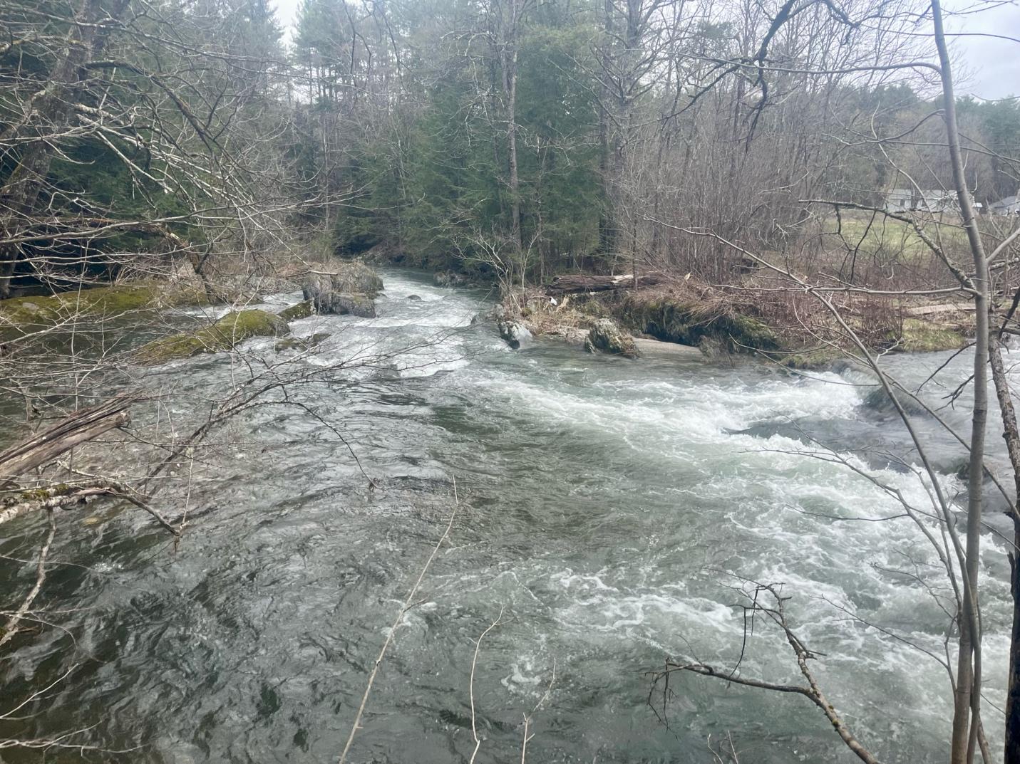
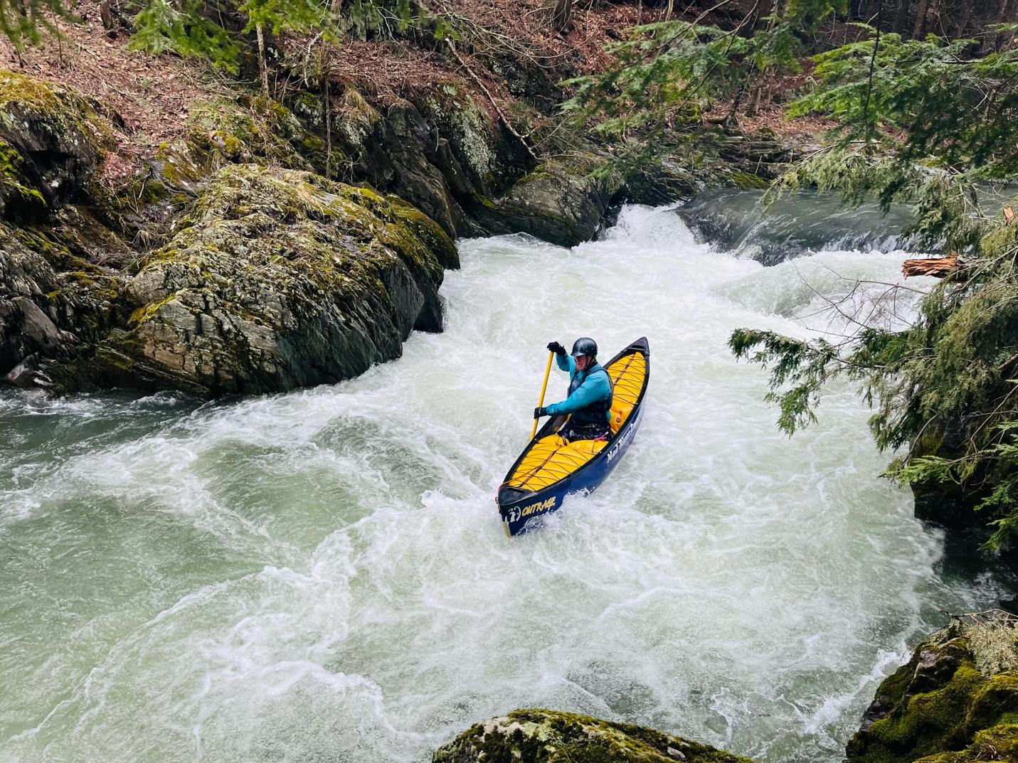
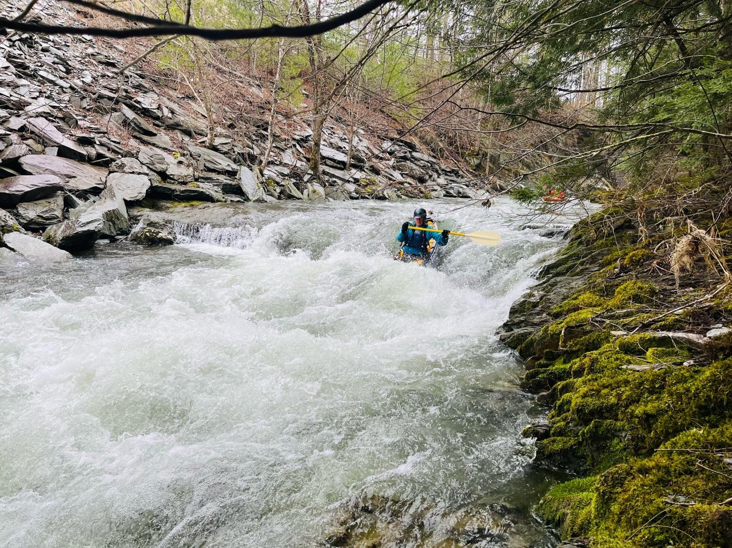
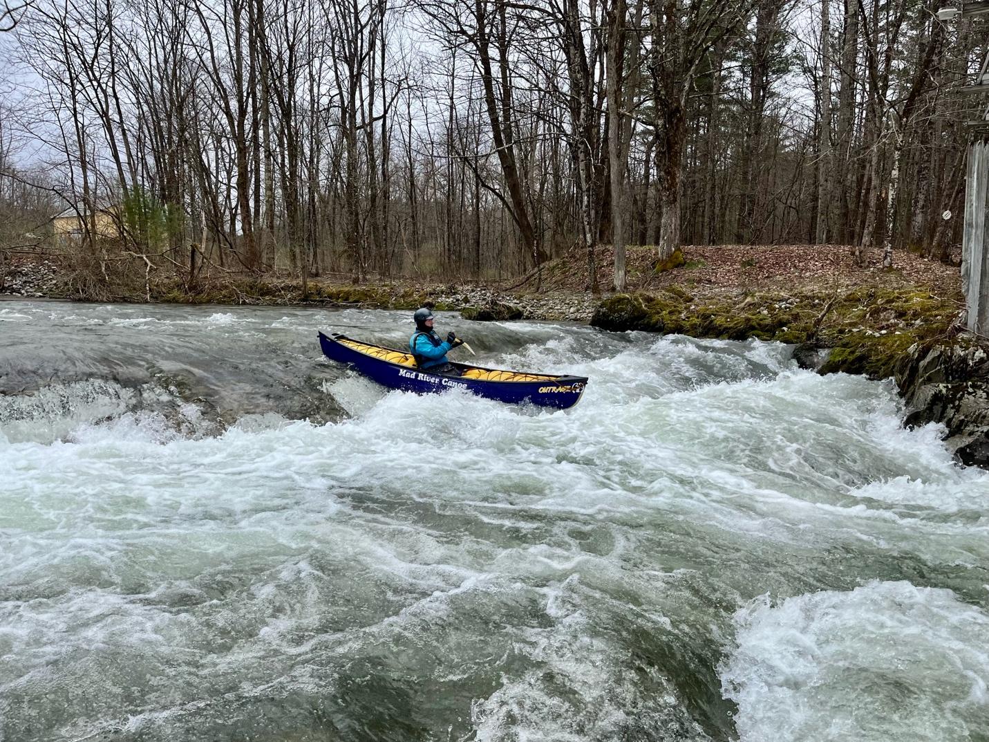
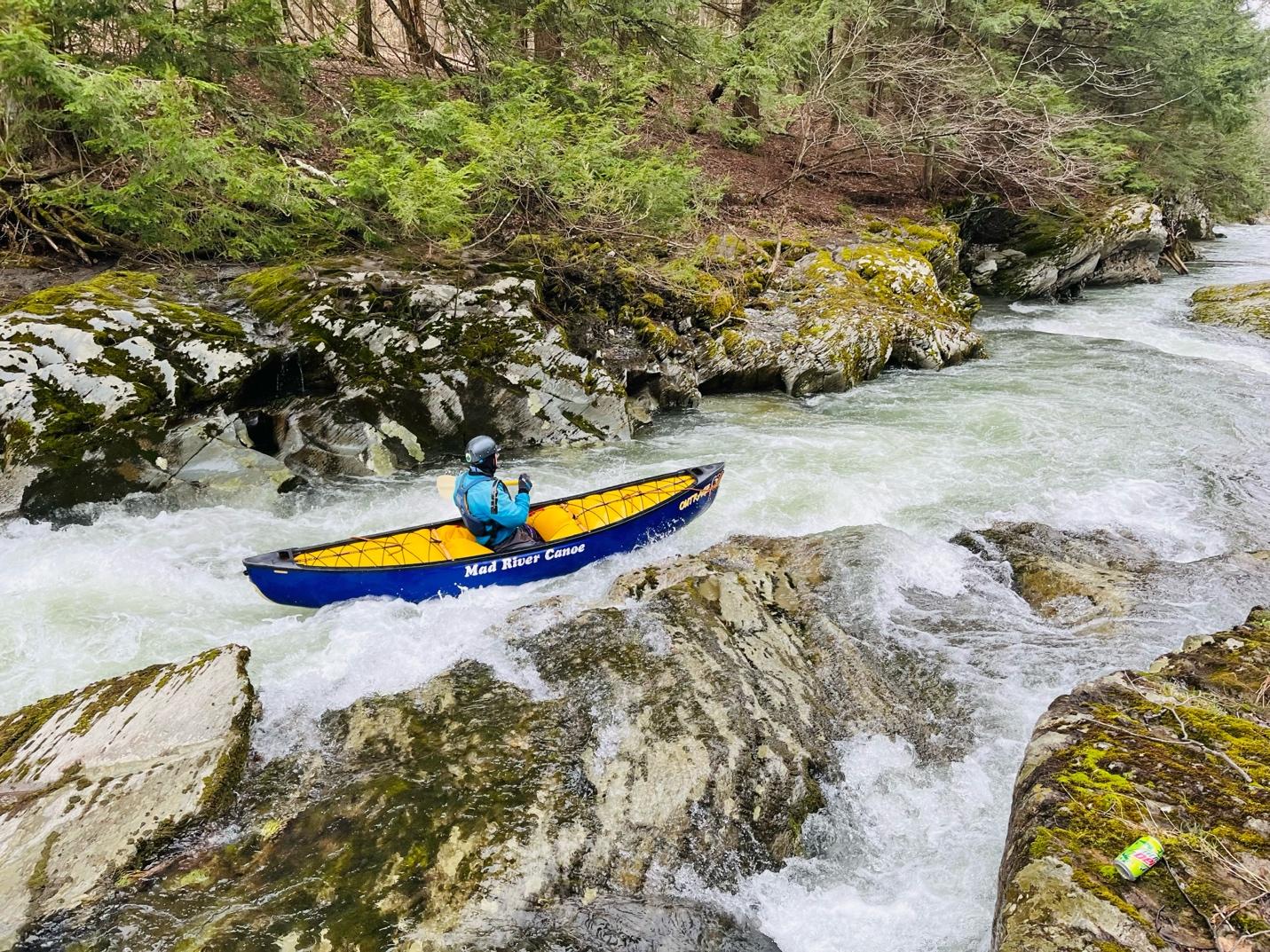
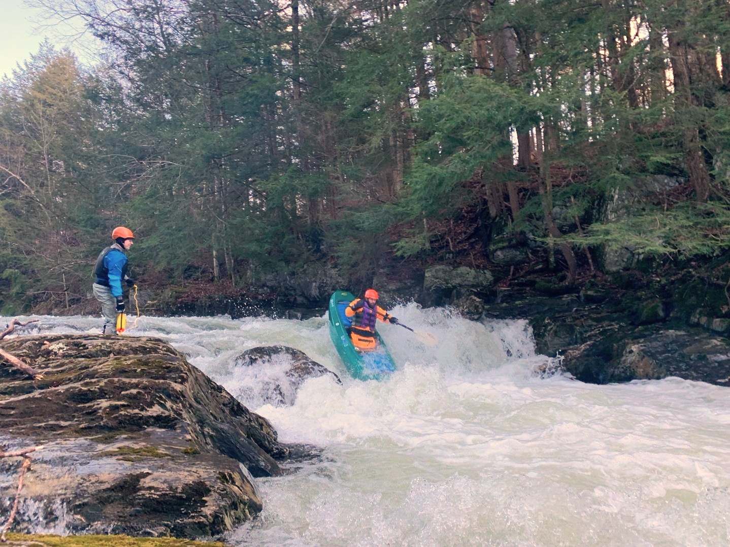
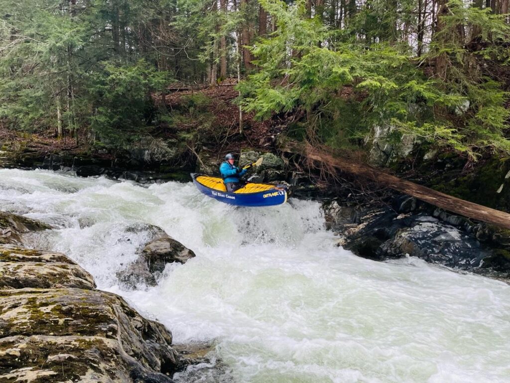
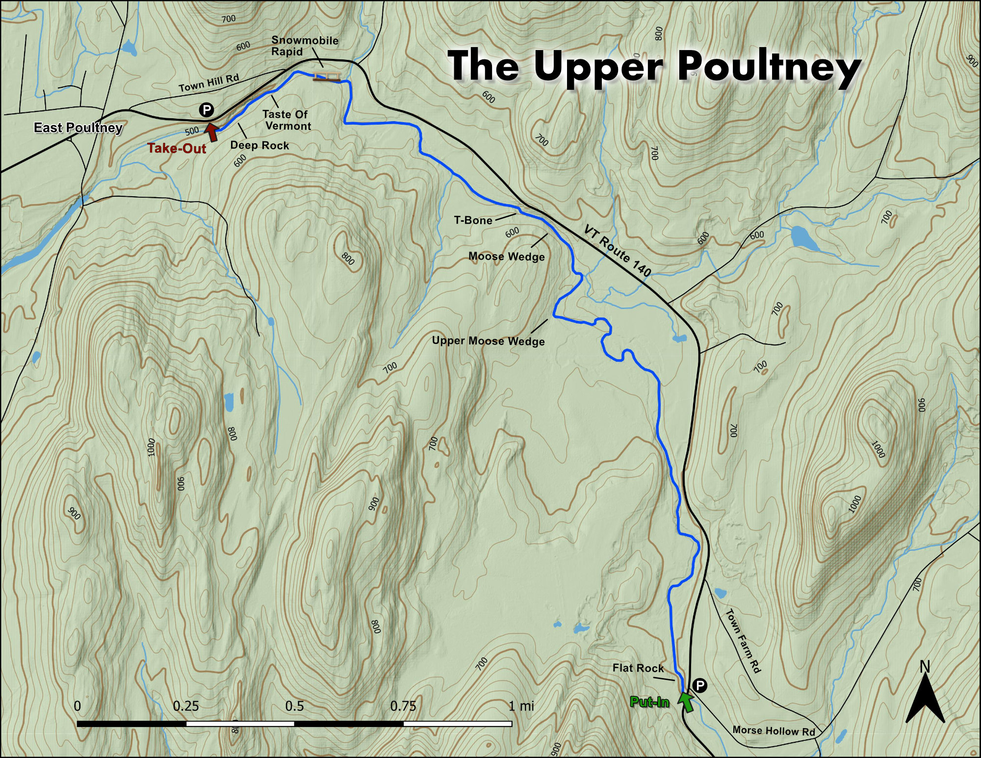
Ok, at the outset, we need to get over something. Some folks (no names here!) turn their nose up and like to knock this run. (“Not enough gnar-gnar, unimpressive gradient, basic ledge drops, etc., etc.) But the truth is they are missing out. Seriously. If you’re looking for a great day on the water with friends, beautiful scenery, two gorges shaded by old hemlocks, several sweet class III ledges with epic boofs and endless practice, neat western VT geology, a great place to introduce new folks to creeking and boating, quick laps, easy-short shuttles, etc., then this is your place. It’s also an excellent run for OC1ers. In addition, the run is perfectly situated in that you can pair it with a big water romp on the Lower Poultney (if the Upper Poultney’s in, the Lower Poultney will likely be on the medium-high side), a Cold River lap, Clarendon Gorge, epic Class IV gravel/adventure biking, mountain biking on the Slate Valley Trails (the “Fairgrounds” trailhead is streamside off the Upper Poultney!), or kicking around the towns of Poultney (approximately 2 miles from the takeout) and Castleton. The takeaway: you should put this on your list.

Finding your way to the put-in is straightforward. Take Route 140 east out of East Poultney. After approximately 2 ¼ miles, Morse Hollow Road will be on your left. Take a left onto Morse Hollow Road. Immediately after turning onto Morse Hollow Road you’ll see a well-defined parking spot on your right adjacent to the bridge and river. (Note: There have never been issues historically with boaters parking here. The owner lives across the street. If you encounter anyone, per usual, please be kind, respectful, and appreciative of letting boaters use the put-in parking area.) After parking, carry your boat down the bank (eroded in places and does have some briars), put-in above the bridge, and commence having fun.

Depending on the level, sometimes a fun play hole forms at the put-in. It’ll be obvious from the parking area whether it’s in.


The first named rapid on the run is Flat Rock (II). It’s just around the bend after the bridge. If you have someone who’s relatively new to boating and creeking, when you’re at the put-in, you can walk across Route 140 and scout Flat Rock. There’s a well-defined pull-off with a foot path down to the rapid for summertime swimming and fishing. The entrance of Flat Rock commonly catches wood—especially in the river left slot—so take a peek before entering. The left line is narrow against the wall. At higher flows, there’s a boof on river right. After the main slot-drop of Flat Rock, at higher flows, a hole forms on the bend at the end of the rapid with good eddy service on the right.

A canoer and kayaker navigate "Flat Rock" rapid on the Upper Poultney River Vermont Whitewater
Tony Shaw and Chris Weed entering Flat Rock
Upper Moose Wedge (II+) on the bend

After Flat Rock, there’s a stretch of wooded and open flat water with some dispersed Class I-IIish water. (You’ll also pass under a snowmobile bridge, which is the “Fairgrounds trailhead” for the Slate Valley Trails.) When navigating through a beavery meadow (watch out for downed logs and trees), you’ll notice the river meeting the woodline again with a hemlock hillside. This is your landmark that you’re approaching what some call “the first gorge” featuring Moose Wedge. The river will drop and sharply bend to the right. There’s good eddy service on river left and river right to scout for wood, which is known to catch on the next narrower drop. (See photo below.) There’s great boof practice for new folks on river right too after the bend. After this, you’ll come into the gorge via flatwater riffles and plenty of sizeable eddies on both sides before Moose Wedge—that is noticeable on the horizon line.

Like the other rapids on this run, we recommend pulling off on river left and scouting Moose Wedge for wood. (Note: You can also pull over and look at Moose Wedge and T-bone from R.140 when driving to the put-in. Be sure to carefully inspect Moose Wedge just below the drop, as well as the run-out/constricted area of T-bone.)

Moose Wedge (III) is a fun ledge drop with multiple lines. At medium and higher flows, there’s a boof on river right into an eddy. Slightly left of center is the traditional “safe” line for folks new to creeking. What’s neat about Moose Wedge is the beauty of the hemlocks, moss covered banks, slot-gorge-nature, and diversity of moves and lines for all abilities. (Note: Due to summertime swimming/trespassing issues, you will notice a lot of No Trespassing signs on the banks. If you do opt to scout, be respectful, leave no trace, and use your best judgement staying below the high water mark. To our knowledge, the controversial confrontations with boaters have historically been on the Lower Poultney below U.S. 4—not this run.) Finally, safety can be set up on river left directly next to, and below, Moose Wedge. If anyone swims, there’s ample recovery space and eddies before the next drop.

Tony Shaw with wide smiles lining up for the runout of Moose Wedge and approaching T-bone
Tony Shaw dropping into T-bone.

Next up fifty yards or so after Moose Wedge is T-bone (aptly named for reasons we won’t mention here). T-bone is a ledge drop with a boof on river right into an eddy (pending flows), and a drop into a wave-hole just left of center. At the bottom of T-bone, the gorge banks constrict even tighter so watch out for wood. Because of the constriction, there are some large boils and pressure forming subsurface potholes in the ledge wall on river left. Some folks have expressed concern about swimmer safety on the river left side of the constriction so keep an eye out and direct anyone swimming to river right (away from the river left wall and pressure) at the bottom of T-bone.

Afterwards, there will be some meadowy flatwater. Eventually, you’ll come to a home on the river left bank with a sizeable concrete erosion wall. Past the home, but before its private low bridge across the river, is a little play hole that forms at different levels.


The river will turn right again with a few Class II ledge rapids (watch for wood) before meeting back up with Route 140 and turning left. At this bend, a small tributary comes in on river right with large eddy service.


Snowmobile Rapid (II+) is next. Snowmobile Rapid—named after the snowmobile/footbridge bridge across it—is another straightforward ledge drop with multiple lines and boofs. At higher flows, its hydraulics can get a bit sticky.

Tony Shaw taking the center line on Snowmobile Rapid
Soaking up the scenery in Taste of Vermont

The river straightens out again after Snowmobile Rapid with flat-riffle water, eddy service, and a few ledge play holes before turning left and entering the “second gorge” leading to Deep Rock (the final and best rapid of the run).


The first rapid in the gorge is Taste of Vermont (III). Taste of Vermont is a clean-narrow ledge-slide on river left. Again, like the other rapids on this run, look for wood which is common at the entrance and bottom of Taste of Vermont. There’s a large eddy on river right before the entrance that makes for easy wood scouting.

The last and best rapid of the run is Deep Rock (III+). For those new to the run, pull out on river right in one of the eddies at the top of Deep Rock to take a peek.


The entrance to Deep Rock has multiple micro-eddies on river left. The key here is to stay close to the river left bank and line up accordingly for the final and best boof of the run. There are a few holes and angled waves to throw you off, so be on guard. Typically, unless it’s on the low side, the boof on river left (which is just shy of a boat’s width in the sweet spot) should be in. Medium level and above is best. If the boof is not in, you can run the mank down the middle.  For folks stoked on the boof or looking for extra practice, you can easily lap it with the eddy and recovery pool below. Safety can also be set on river right, if desired.

Gregg Freeman taking the road less traveled and heading for the mank in the middle line.
Tony Shaw airborne in his OC1 on Deep Rock

The takeout is on river right at the end of the gorge where you’ll see a pasture-meadow on river right. Takeout and walk up the bank to the road. Be careful of the blind corner on 140 as folks often drive too fast. It’s worth hucking boats to the pullout around the bend (headed east) on the straightaway to load up.

Finally and importantly, as previously mentioned, there are a lot of No Trespassing signs on the banks of this run, especially in the two gorges. Our understanding chatting with locals is that they’re primarily directed at summertime swimmers getting into shenanigans. If you do encounter anyone, per always, be respectful. In that vein, Analog Cycles (a local gem of a bike shop based in East Poultney and Poultney) are great people and super supportive of boaters, and outdoor recreation generally in the area. They know almost everyone in the community if there is an encounter or issue. If you get a chance, stop in their shop, say hello, and spread the cheer.

Stepping Stones

Creek VT river guide coming soon
Not quite ready for The Upper Poultney? The White River in Stockbridge is a great place to build confidence.
Guide to Patterson Brook Upper White River Vermont Whitewater Kayaking
If you like The Upper Poultney, then you're sure to enjoy the Patterson Brook
Creek VT river guide coming soon
Looking to step it up? The New Haven ledges will provide plenty of challenge.